This article is the latest in a series about computer models and their uses within the Puget Sound ecosystem.
As scientists uncover more and more information about a particular ecosystem, computer modelers are often eager to put that raw data to good use in complex models tuned to local conditions. One highly acclaimed model, called Atlantis, has been applied to more than 40 ecosystems around the world.
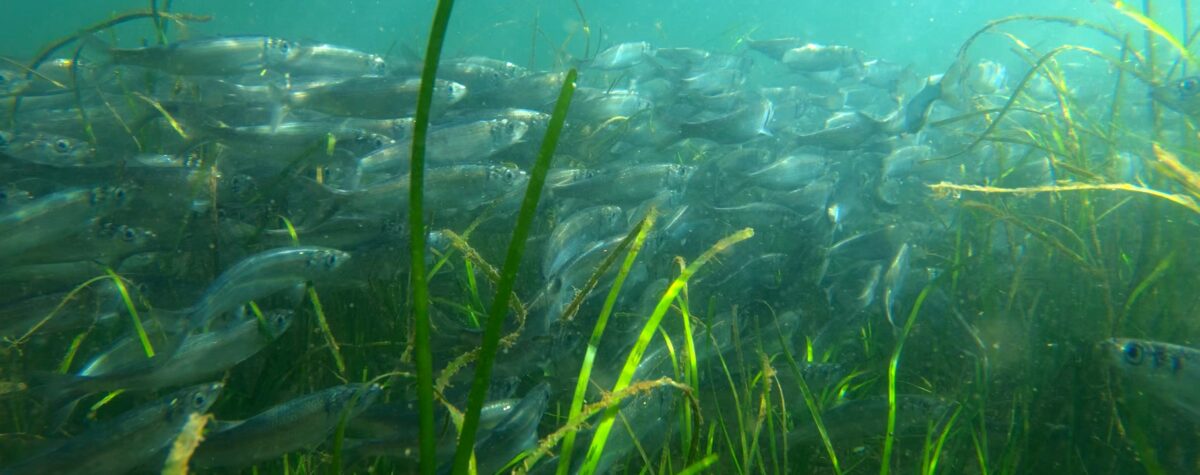
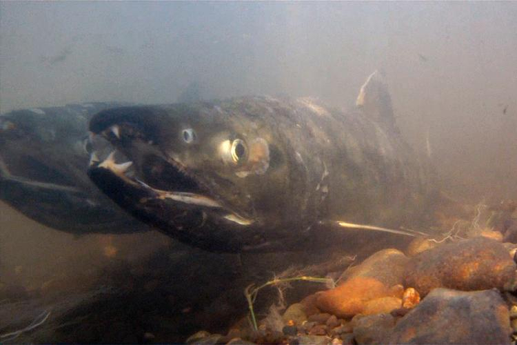
In Puget Sound, Atlantis has been used to study the food web to determine whether salmon are more threatened by predators or by the lack of a stable food supply. It turns out that one way to help salmon would be to find ways to increase the local herring populations, according to researchers at Long Live the Kings who are leading the project.
The model also is being used to evaluate the benefits of specific recovery actions meant to help the endangered Southern Resident killer whales. Results of the modeling project also will reveal the costs and tradeoffs inherent in those recovery actions. Other studies based on the Atlantis system are considering the risks of an oil spill in the Salish Sea, and plans are underway to examine the cumulative impacts of climate change on the local ecosystem. In addition, Atlantis is part of a four-model project called the Puget Sound Integrated Modeling Framework led by Puget Sound Institute.
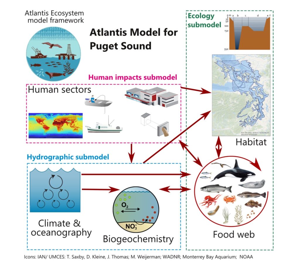
The three-dimensional Atlantis model, developed by an Australian research scientist, Beth Fulton, is able to distinguish habitat differences from place to place, as defined within the model’s domain. The model accommodates equations used to represent physical, chemical and biological processes taking place. It can even weave in direct human involvement, such fisheries management, habitat improvements and economic outcomes.
Indicative of the model’s complexity, Atlantis is distinguished by its modularity, which allows for changeable “submodels” to simulate specific processes. It also has the capability to pull in data from full-blown independent models developed for explicit purposes.
A 2007 analysis for the United Nations Food and Agriculture Organization ranked the Atlantis system as the best model in the world for considering outcomes from alternative fisheries actions and ecosystem management. Although the value of Atlantis has been proven with its widespread use, Beth Fulton remains introspective about its origins.
“Atlantis was never intended for anyone else’s use, but was simply the ecological sandbox for me to explore my understanding of the marine world and how to represent it mathematically,” she noted in her introduction to the 231-page “Atlantis User’s Guide.”
“It has been a huge shock to see it adopted by others,” she added, “and I remain deeply apologetic for how difficult it is to use. If I had ever known how it would be used, I would likely have done things differently.”
No matter its origins, the model has evolved and improved through new applications and with the collaboration of hundreds of users, which Fulton lauds for their collective intellectual power.

As for its given name, “Atlantis” was christened by Villy Christensen, an early developer of the Ecopath model, which we discussed in a previous blog post. Christensen suddenly posed the new name during a conference in South Africa while introducing Fulton to the audience. He said the new model deserved a better name than “Box Model 2,” which Beth had used for her doctoral thesis. Since 2001, she has been affiliated with the Commonwealth Scientific and Industrial Research Organization (CSIRO), Australia’s largest government-sponsored science institute.
In mythology, Atlantis was purportedly a large island, the home of an advanced civilization, that sank into the ocean in the distant past. For centuries, explorers, scientists and psychics have tried unsuccessfully to locate this imaginary place in the real world. In computer modeling, as in legends, human imagination can lead to discovery, but only when grounded in true-to-life observations.
Atlantis and Puget Sound model structure
Within an ecosystem, the three-dimensional Atlantis model represents local geography with boxes shaped as polygons of varying sizes as needed to fit the landscape and capture the ecological processes in sufficient detail. The boxes are extended and segmented vertically to capture depth-related differences, such as temperature, salinity, pH and oxygen. Primary processes engendered in the model are consumption, production, waste generation, predation, recruitment, habitat dependency and mortality, along with movement and migration of species from one place to the next.
The model is designed to include every species found within a food web, from plankton to top predators. Organisms are sorted into functional groups, each representing a single species or often a collection of similar species.
A built-in clock allows users to play out scenarios over days, months and years, based on real or imagined conditions. Choices for beginning and end dates are limited only by available information and careful management of uncertainty.
“For anyone new to Atlantis,” Fulton wrote in her user’s guide, “coming to grips with it is like climbing Olympus Mons (a 72,000-foot-high volcanic mountain on Mars). It is not for everyone, particularly as it is very data and time sensitive. Much like cooking a good stew, go lightly with the spice and concentrate on the hearty base constituents. Most of all, try to relax and have fun.”
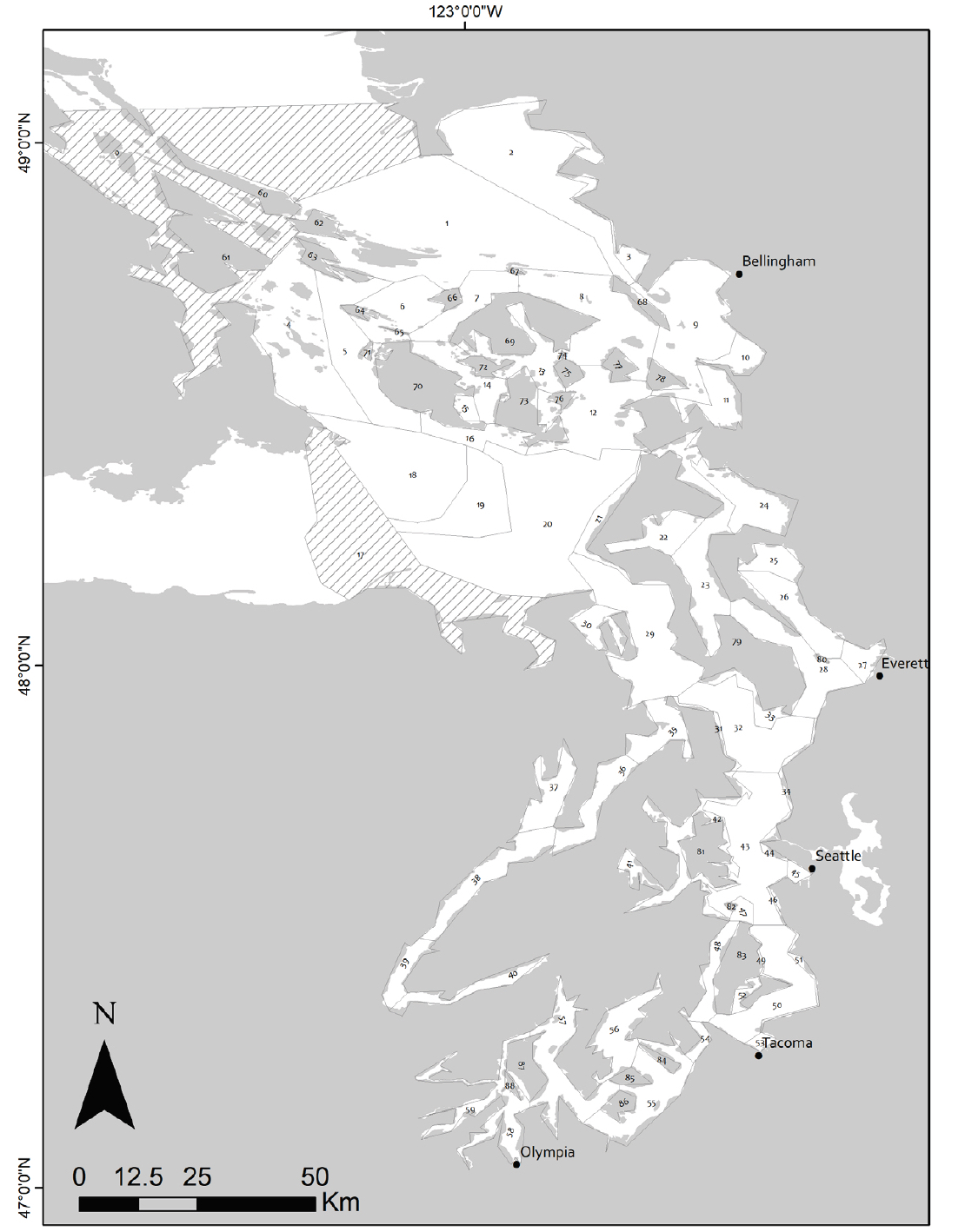
Atlantis is customized for each ecosystem under study. The Atlantis Model for Puget Sound, originally developed for the Salish Sea Marine Survival Project, places living organisms into 73 functional groups. They include 22 groups for salmon alone, divided by local populations and life stages. There are 17 other fish groups, 12 groups of invertebrates, seven groups of mammals, four groups of zooplankton, three groups of seabirds, two groups of bacteria, plus several other groups. Populations are distributed through Puget Sound based on available information, including reports of commercial and sport fishing with their estimated effects on biomass.
The model uses nitrogen as its “currency” to represent unit changes in biomass as a result of ecological activity, including food consumption, waste production or mortality from predation. Diets for each species were taken from 149 published sources along with a few unpublished studies in Puget Sound and the southern Strait of Georgia in Canada.
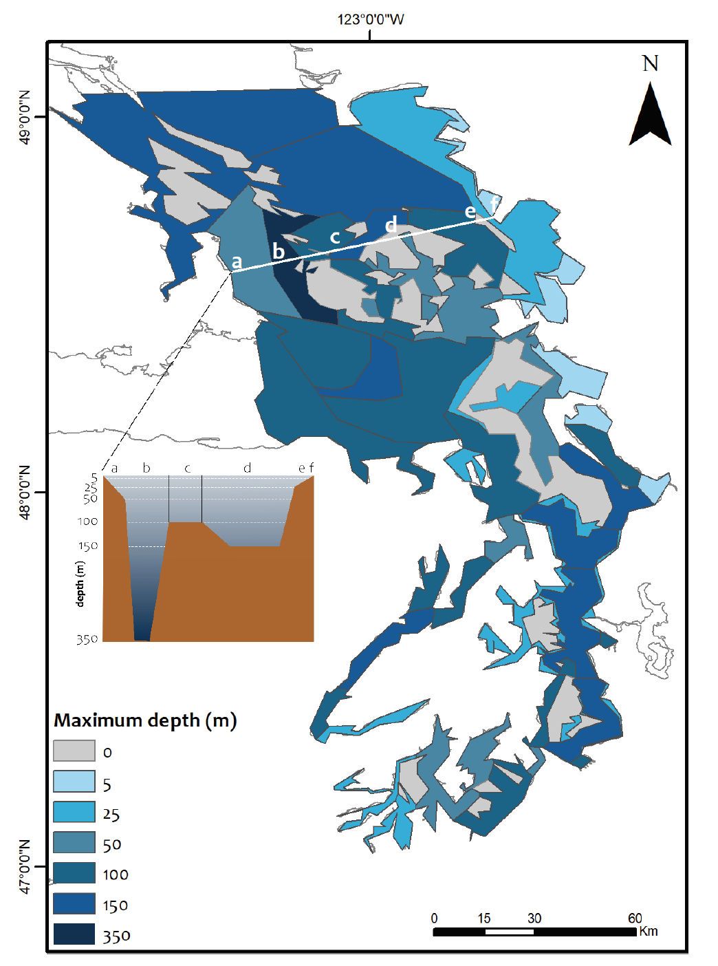
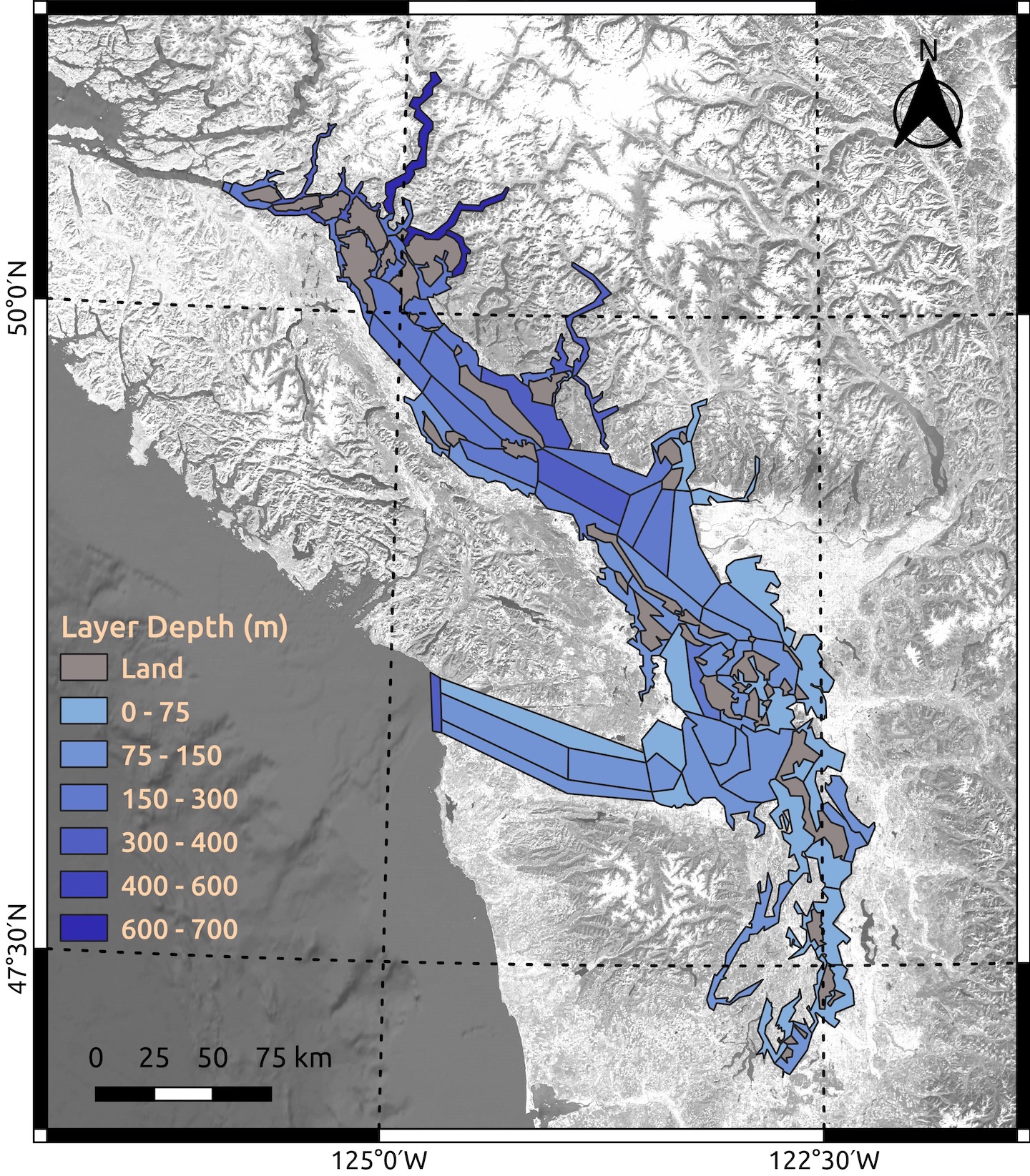
Geographically, the Atlantis Model for Puget Sound consists of 89 strategically placed polygons extending over 3,726 square miles. Besides 29 polygons that encompass islands, 60 “water-column polygons” extend from the surface to the bottom. Each is divided vertically by depth — up to six layers for the deepest parts of Puget Sound — plus one sediment layer that captures important biological activity on the bottom.
Sources of nitrogen and silica coming into Puget Sound were derived from actual measurements and external models, such as the Puget Sound Dissolved Oxygen Model developed by the Washington Department of Ecology. These nutrient inputs are important to the production of plankton, which can contribute to low-oxygen problems under certain conditions.
Estimates of circulation, temperature and salinity — all important drivers of the food web — were taken from the output produced by the Regional Ocean Modeling System, a high-resolution model used in a variety of coastal and estuarine applications. Calculations of water volume traveling from one polygon to the next were adjusted slightly to correct for time differences between the two models, ensuring that total volume was conserved for every area of Puget Sound.
Solar radiation, another important driver of plankton production, was taken from data collected at SeaTac Airport and averaged for each calendar day for the duration of the model run.
The Atlantis Model for Puget Sound continues with support from NOAA’s Northwest Fisheries Science Center. Ongoing studies are being conducted under the leadership of Hem Nalini Morzaria-Luna of Long Live the Kings, a conservation group. Dozens of federal, state, tribal and university partners have been involved in this particular modeling effort as well as other aspects of the Salish Sea Marine Survival Project, which was jointly conducted from 2013 to 2021 by Long Live the Kings in the U.S and the Pacific Salmon Foundation in Canada.
Preliminary findings for salmon
Researchers have long suspected that human activities contributed to the decline in Puget Sound salmon populations and may be thwarting recovery efforts. Suspects include population growth, shoreline development, deforestation, pollution and over-fishing, among other factors. A decline in early marine survival among Puget Sound Chinook — but not coastal Chinook — suggested early on that the problem lies within the Salish Sea, not out in the ocean.
One of the major questions posed to the Salish Sea Marine Survival Project was whether the effects on salmon are primarily the result of predation — a “top-down” threat — or the lack of available food supplies — a “bottom-up” threat. Both are closely related to the structure and dynamics of the food web.
With help from the Atlantis Model for Puget Sound, researchers ran a series of scenarios to test the effects of various perturbations within the food web. These perturbations involved simulating a 20 percent increase and a 20 percent decrease in selected populations within the model and observing the effects over a 30-year period. These were among the selected populations chosen for the simulations:
- Jellyfish, which can eat plankton in competition with juvenile salmon and reduce fish abundance by preying on fish eggs. Most jellyfish have few predators to keep their numbers in check.
- Hatchery salmon, which can increase competition for food among certain groups of salmon. Simulations released Chinook, coho and chum as yearlings and subyearlings in various combinations.
- Herring, which are a significant food source for salmon and many other fish. They also compete directly with juvenile Chinook, chum, pink, coho and sockeye salmon. Common prey for most of these species include crab larvae, krill and crustaceans.
- Chum salmon and pink salmon, which are the most abundant salmon species in the North Pacific Ocean. Simulations increased populations at the subyearling stage of development. Studies suggest that annual returns of chum and pink salmon are subject to cycles related to shifts in the food web that could also affect Chinook and coho.
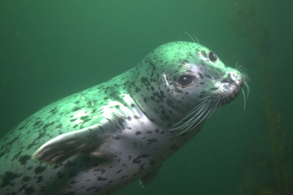
- Predation effects, focused on salmon predators, were modeled by sequentially increasing and decreasing the number of pinnipeds (harbor seals, California sea lions and Steller sea lions), harbor porpoises, seabirds and spiny dogfish.
- Cumulative impacts, which relate to multiple changes all at once, were tested in various scenarios by putting together all bottom-up drivers, all top-down drivers and both top-down and bottom-up drivers.
The findings of the modeling study, which will be detailed in an upcoming publication, include stronger effects caused by the bottom-up drivers related to food supply than by the top-down drivers related to predation, according to Morzaria-Luna. The paper will soon be submitted to the Canadian Journal of Fisheries and Aquatic Sciences. It will then be subject to peer review.
General findings of the study included negative effects on overall salmon abundance when increasing the number of hatchery salmon, wild pink and chum salmon, and jellyfish, all related to competition for food. Negative effects were also seen by decreasing herring, an important prey species for salmon.
The effects are not uniform throughout Puget Sound, which the Atlantis model reveals through its spatial configuration, according to Morzaria-Luna. For example, because of the distribution of zooplankton, we are likely to see more jellyfish in South Puget Sound with stronger negative effects on salmon in that region, she said.
“A decrease in herring consistently had a negative impact, which would suggest that efforts to increase herring would have beneficial effects,” she said. “That could mean that increasing habitat, such as eelgrass, could help the herring (and thus help the salmon).”
Ongoing studies
Scientists are using the Atlantis Model for Puget Sound to evaluate the effectiveness of recovery actions undertaken or proposed to help the endangered Southern Resident killer whales. The project is led by Morzaria-Luna of Long Live the Kings with support from NOAA’s Northwest Fisheries Science Center and others. With the involvement of Canadian researchers and additional modeling capabilities at the University of British Columbia, the widescale project will consider effects in both the U.S. and Canada.
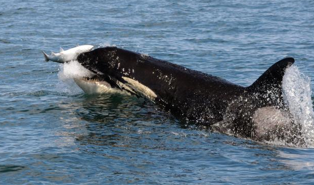
In Washington state, recommendations by the Governor’s Southern Resident Orca Task Force call for actions addressing prey availability, toxic contaminants, disturbance from vessels and more. One recommendation specifically calls for a study to consider the ecological effects of actively removing seals and sea lions from local waters. In British Columbia, various policies have been imposed to reduce vessel impacts and to protect the orcas’ feeding areas.
Since the Atlantis Model for Puget Sound does not cover the entire Salish Sea, researchers have developed another version of Atlantis — called the Salish Sea Atlantis Model. With funding from the Canadian Multi-Partner Research Initiative, the model’s geographic domain overlaps with that of the Puget Sound version. Salish Sea Atlantis was built with functional groups for the orcas, salmon and many other species, but the design includes fewer salmon groups, which were a major focus of simulations in the Puget Sound version.
The newer Salish Sea Atlantis Model includes a fate-and-effects submodel that can simulate the ecological risks of oil spills. Public and scientific interest in the effects of oil spills have grown with Canada’s plans to expand the Trans Mountain Pipeline, which carries oil from Alberta to the Salish Sea. Experts estimate that the expanded pipeline could lead to a seven-fold increase in tanker traffic plying the inland waterways to and from Vancouver, BC.
In addition to an evaluation of the ecological outcomes of recent policies, future modeling projects will consider the risks and cumulative effects of ongoing population growth, development, and climate change, with an eye on unintended consequences and economic tradeoffs.
Results of these studies could reveal potential effects of recovery actions and other human activities, the researchers say, and that could help policymakers resolve conflicting values in the quest for ecosystem health.
Up next: Salish Sea model and its approach to water-quality analysis
Other blog posts in this series about modeling in the Puget Sound region:
- Six things that people should know about ecosystem modeling and virtual experiments
- Before supercomputers, a structural model helped scientists predict currents in Puget Sound
- Researchers use a qualitative network model to test ways to boost production at shellfish farms
- Health of killer whales examined through Bayesian network modeling and informed predictions
- Quantitative models, including Ecopath, take food web studies to a higher level of analysis
Congratulations to the authors of this article. It does an excellent job of introducing us to Atlantis and its applications so far in Puget Sound.
Do any of the referenced studies consider the impact of expanded industrial aquaculture in Puget Sound? A few years ago, a dive boat anchored for several days over a leased geoduck site in Henderson Bay. When it left, the incoming tides littered the shores of Burley Lagoon with hundreds of eelgrass shreds, many include roots. The bullkelp were impacted. Before that harvest, the Purdy Spit was covered with bullkelp and eelgrass. Neither have returned in visible numbers.
Do the studies consider the impact of industrial geoduck farming on salmon returns. Where I have seen plantings (Nisqually Reach area) the beach is clear cut (scraped clean) of all surface living organisms before planting. There are now acres and acres of beach clearing on a regular basis.
Heather and David,
The issue of geoducks and salmon was addressed to a limited extent in the study by Jonathan Reum, which I discussed in the piece about qualitative network modeling.
The Atlantis model might be a good one to deal with food-web impacts based on habitat changes, but a quantitive approach would need data about the species affected by geoduck farming.