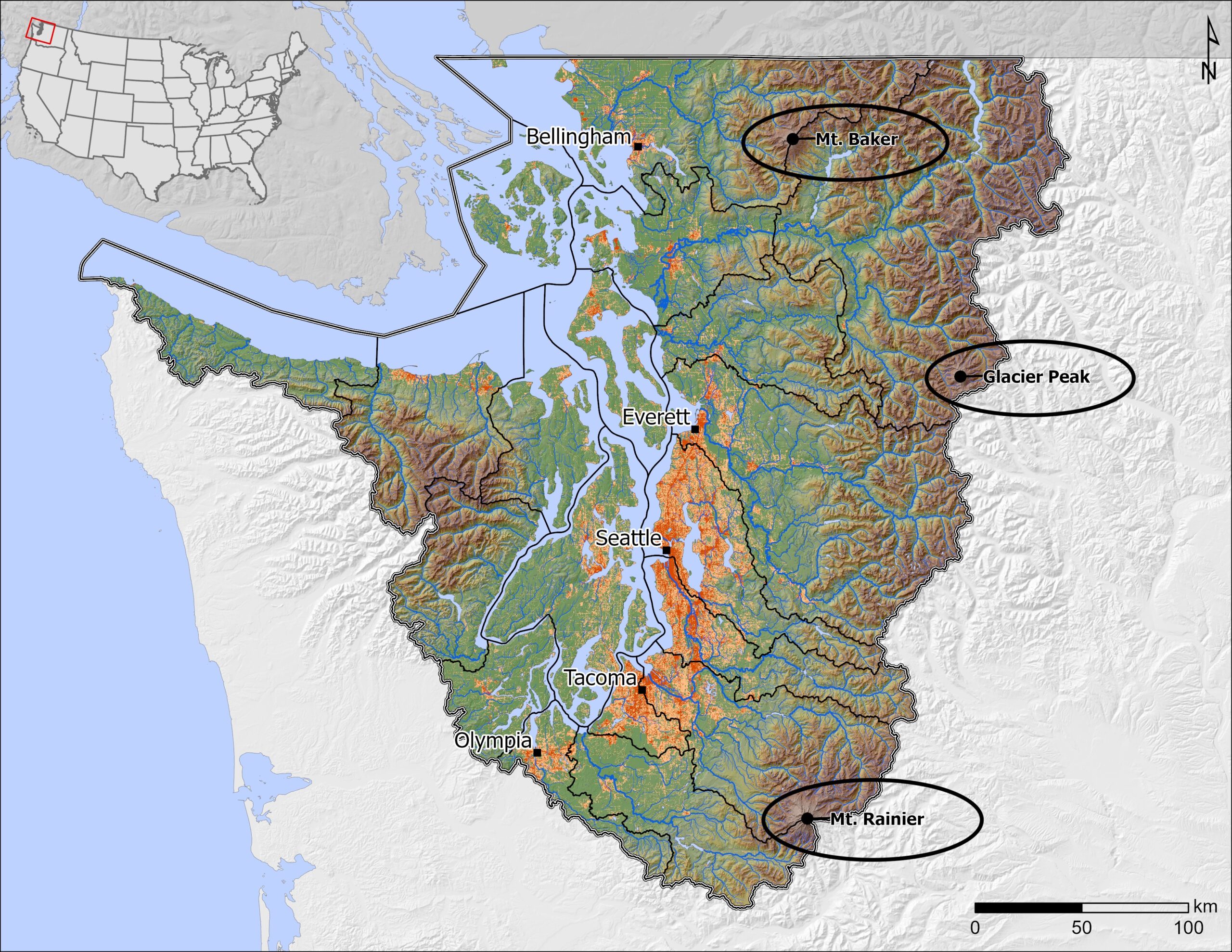
The Puget Sound and Salish Sea watersheds contain many incredible geographic features, but it’s not always easy to tell which ones are truly part of the region. Does Puget Sound really include three active volcanoes? (Yes! See above.) How far north does the Salish Sea extend? And does that reach as far as Canada’s wonderfully named […]
January 30, 2020
PSI is hiring a GIS Specialist
–The position has been filled– The Puget Sound Institute at the University of Washington is seeking a GIS Specialist to work on geospatially explicit tasks relating to the regional strategy to restore and recover valued components of the Puget Sound ecosystem. These include data acquisition, development, maintenance, mapping, and basic geospatial analysis. The position is […]
February 22, 2012
PSI collaborates with NOAA on Puget Sound maps
The Puget Sound Institute is collaborating with the National Oceanic and Atmospheric Administration (NOAA) to enhance a new web-based mapping resource for Puget Sound. The project will utilize NOAA’s Environmental Response Management Application® (ERMA) within the Institute’s forthcoming Encyclopedia of Puget Sound to bring together a wide array of GIS and oceanographic data. ERMA was […]