PSI’s Encyclopedia of Puget Sound has a number of new features on its Maps/GIS page. We have improved access to the maps and data from our collaboration with NOAA’s Office of Response and Restoration. Nigel Heinsius at UW Creative Communications created a new interface that allows users to view GIS metadata without leaving the Encyclopedia website, and there are also many new map layers.
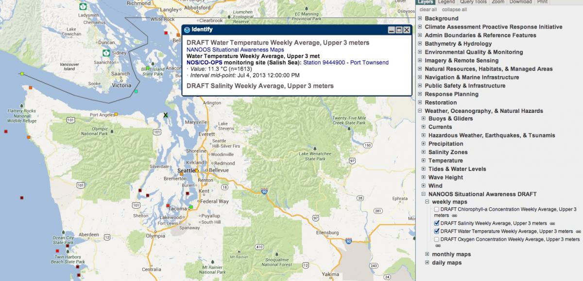
Of particular interest are layers provided through a collaboration with NANOOS that offer daily, weekly or monthly averages of monitoring data for Puget Sound and parts of the Georgia Basin. Currently, you will find this data for salinity, water temperature, chlorophyl and dissolved oxygen levels. Visit NOAA’s Environmental Response Management Application (ERMA) to view these layers (listed as “Pacific NW recent in-situ observations”). Thanks to Emilio Mayorga of NANOOS for writing the code to access this data.