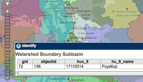
The Puget Sound Institute is collaborating with the National Oceanic and Atmospheric Administration (NOAA) to enhance a new web-based mapping resource for Puget Sound. The project will utilize NOAA’s Environmental Response Management Application® (ERMA) within the Institute’s forthcoming Encyclopedia of Puget Sound to bring together a wide array of GIS and oceanographic data. ERMA was first used extensively in the Deepwater Horizon oil spill, and the same mapping application is now being customized for the Puget Sound watershed and Northwest area.
NOAA has been testing and developing a Puget Sound version of ERMA internally as part of its Climate Assessment and Proactive Response Initiative (CAPRI), including a pilot study of impacts of climate change and sea level rise on contamination sites within Puget Sound. The Puget Sound Institute began working with NOAA in late 2011 to provide additional maps related to a wide variety of spatial frameworks, ranging from hydrology and Puget Sound Basin characterization to occurrences of invasive and threatened species. Eventually, the Institute will also enlist the wider scientific community to suggest or offer maps for inclusion.

ERMA was jointly developed at NOAA and the University of New Hampshire, and is designed as a user-friendly, but robust online interface. It can combine thousands of map layers as well as near real-time weather, buoy and ship tracking information.
The mapping application first came to prominence in 2010 when it was used during the Gulf oil spill. The ERMA site received 3.4 million hits on the first day it was launched, and was able to chart such crucial information as the extent of the oil spill, fishery closures, and locations of response vessels.

ERMA’s Puget Sound node will be featured as a prominent part of the online Encyclopedia of Puget Sound, which begins beta testing this coming spring. The Encyclopedia will include a wide variety of vetted source materials ranging from multimedia to maps and articles contributed by the Puget Sound science community.
For more information about ERMA and to take the mapping system for a test drive, visit ERMA Gulf Response or ERMA Pacific Northwest.
