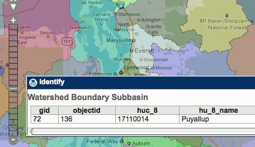
The Puget Sound Institute is collaborating with the National Oceanic and Atmospheric Administration (NOAA) to enhance a new web-based mapping resource for Puget Sound. The project will utilize NOAA’s Environmental Response Management Application® (ERMA) within the Institute’s forthcoming Encyclopedia of Puget Sound to bring together a wide array of GIS and oceanographic data. ERMA was […]